Drone Real Estate Photography in Atlanta: When Aerial Images Add Real Marketing Value
The body content of your post goes here. To edit this text, click on it and delete this default text and start typing your own or paste your own from a differenDrone Real Estate Photography in Atlanta: When Aerial Images Add Real Marketing Value
Atlanta Drone Real Estate Photography: Who This Guide Is For and What You'll Learn
If you market commercial properties in Atlanta, you've likely considered whether drone real estate photography is worth the investment or just a visual luxury. This guide is written for brokers, developers, property managers, and real estate professionals who need a clear answer to that question before spending a dollar on aerial content.
Drone real estate photography Atlanta - sometimes called Atlanta aerial real estate photography - refers to using FAA-compliant unmanned aircraft to capture high-resolution stills and video of properties from elevated perspectives. It's not about flashy tech. It's about showing potential buyers and potential tenants the spatial relationships, access points, and surrounding context that ground-level photos simply cannot communicate.
Throughout this article, Masterly Property Visuals breaks down the specific use cases where aerial imagery moves the needle for Atlanta commercial real estate, how drone shoots work alongside ground-level professional photography, what FAA compliance demands in this city's complex airspace, and how to decide whether your next listing justifies the investment. The perspective here reflects Atlanta's unique context: a dense tree canopy, rapid growth along the BeltLine, logistics hubs near I-75 and I-85, and airspace constraints tied to one of the busiest airports in the country.t source.
When Drone Real Estate Photography in Atlanta Actually Moves the Needle
Not every listing needs a drone. A 1,200-square-foot office space in a suburban strip center probably doesn't. But certain Atlanta property types see outsized returns from aerial imagery, and the data backs it up: aerial footage listings sell 68% faster, according to the National Association of Realtors. Drone photography is particularly effective for luxury and specialty properties, and it applies just as strongly to commercial assets where scale, access, and setting drive value.
Here are the asset types where drone content consistently earns its cost in metro area markets:
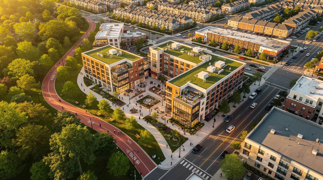
- Infill redevelopment sites off the Atlanta BeltLine where surrounding context is the selling point
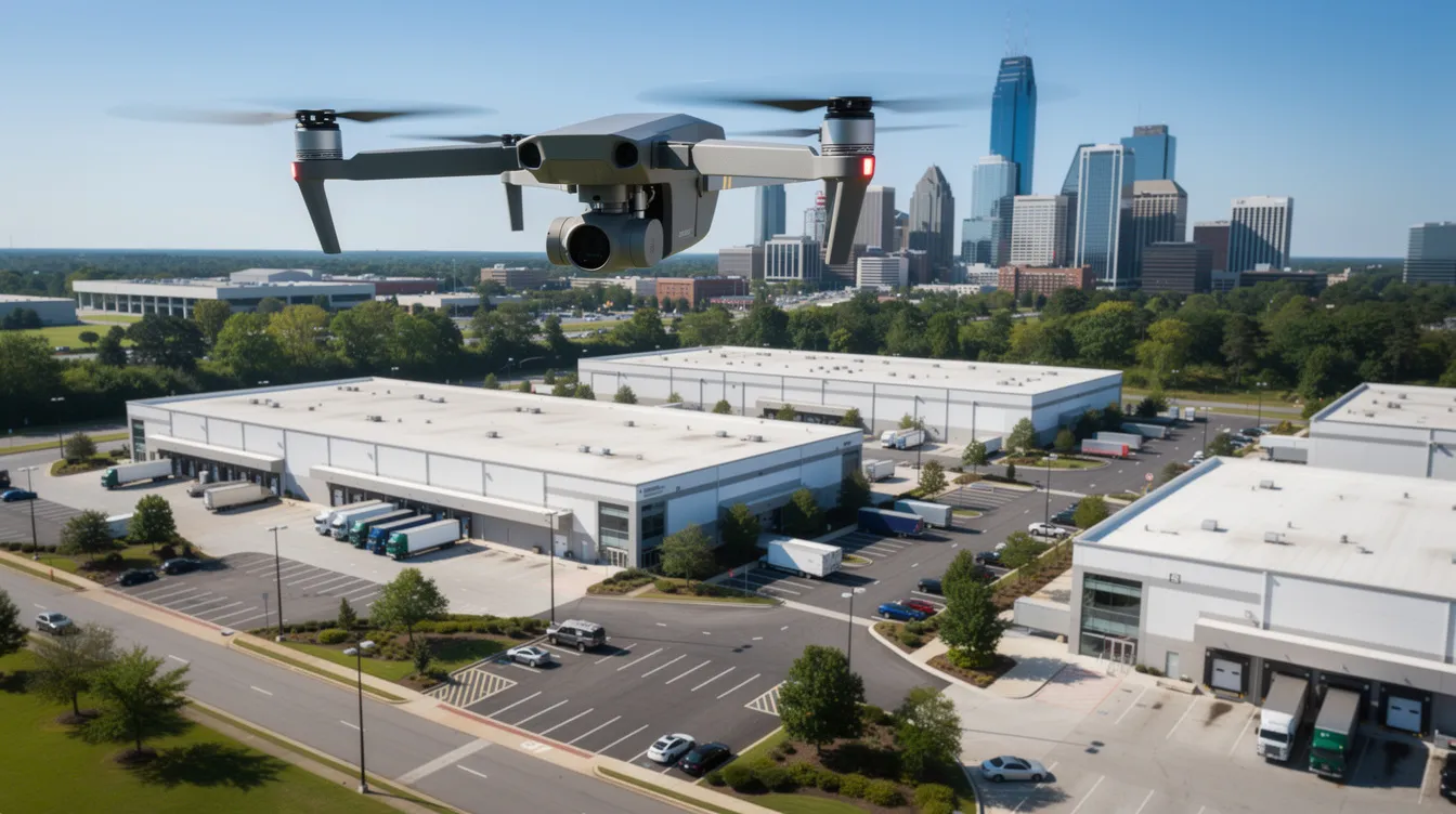
- Logistics and distribution facilities near Hartsfield-Jackson airport and along I-75/I-85
- Mixed-use projects in Midtown and West Midtown where walkability and density tell the story
- Suburban retail along Peachtree Industrial Boulevard or GA-400, where road visibility and co-tenancy matter
- Multi-family communities in Sandy Springs or Buckhead, where amenity layouts and skyline views attract buyers
- Industrial parks in South Fulton, where truck courts, dock doors, and highway proximity define value
Drones highlight the property's scale and setting more effectively than any ground shot. By contrast, small interior-only suites or lower-visibility commercial properties where interior upgrades matter more often benefit from ground-level photography first. Think about your deal goals - lease-up, pre-leasing, capital raises, or disposition - and match the imagery to the objective.
How Aerial Imagery Changes the Story of an Atlanta Commercial Property
A single overhead photo can answer questions that a 20-page offering memorandum struggles to communicate: traffic patterns around a retail center, ingress and egress for an industrial campus, or how a Midtown high-rise sits relative to MARTA stations and corporate headquarters. Drones provide a perspective on properties that traditional photography does not offer, and in a market where 97% of buyers view online listings before visiting properties, that perspective shapes every first impression.
Consider how drone photography captures expansive property boundaries and unique neighborhood proximities. A retail center's relationship to the BeltLine trail becomes immediately clear from 200 feet. A distribution center's proximity to I-285 interchanges is obvious in one frame. Skyline views from a Buckhead office building gain context that no lobby photo can replicate. Listings with professional photos sell 32% faster than those with amateur photos, and the gap widens when aerial content is part of the package.
For development site photography in rapidly changing neighborhoods like West Midtown or East Atlanta, aerial imagery supports zoning and entitlement narratives by showing surrounding density, street grids, and growth corridors. Marketing decks for investors and site selection teams evaluating expansion into Georgia benefit from this visual representation of what a map alone cannot convey.
Atlanta's history adds another layer. The civil rights movement shaped neighborhoods like Sweet Auburn, and landmarks including the Martin Luther King Jr. National Historical Park sometimes appear in context shots. These elements must be handled respectfully in marketing narratives, acknowledging the city's cultural attractions while focusing on the subject property.
Core Drone and Ground Services for Atlanta Commercial Real Estate
Effective property marketing combines aerial and ground perspectives into one unified visual story. At Masterly Property Visuals, the focus is commercial real estate photography - not weddings, events, or unrelated drone services. Every shoot is structured to serve brokers, owners, and leasing teams who need professionally edited images that perform on CoStar, LoopNet, and in offering memoranda.
Drone services in Atlanta include aerial photography and videography, and those services are available across all 50 states, including Atlanta. Core offerings break into clear categories:
- Development site photography for pre-construction and entitlement campaigns
- Stabilized drone video fly-throughs for investor decks and digital deal rooms
- High-resolution aerial still imagery for print and web
- Exterior and interior professional photography for complete listing packages
- Virtual staging for vacant commercial properties where furniture and finishes need visualization
Commercial real estate photography costs range from $350 to $1,000 depending on asset size, deliverables, and airspace complexity. Professional photos help listings stand out in competitive markets, and consistent file naming, aspect ratios, and resolutions ensure images perform across every platform your marketing efforts touch. All drone operations are FAA-compliant, managed by pilots experienced in Atlanta's Class B airspace environment.
Aerial Photography: Capturing Atlanta From Above
Ground-level photography shows what a property looks like. Aerial photography shows what it means - its position in the market, its relationship to infrastructure, and the quality of its surroundings. Drone photography provides a clear bird's-eye view for real estate marketing that transforms how real estate photographers present commercial properties to clients.
Common aerial angles serve different purposes for Atlanta listings:
- Straight-down orthographic views work for parcels along corridors like Buford Highway, clearly showing lot boundaries and square footage
- 45-degree oblique shots capture mid-rise projects against the Downtown or Buckhead skyline, adding depth and context
- Higher-altitude mapping shots cover entire industrial parks in South DeKalb or logistics campuses in Henry County
Aerial photography highlights property locations and nearby amenities - from adjacent retail anchors to parks and transit stops. Aerial imagery helps showcase dense tree canopies and suburban yards in residential-adjacent areas, while high-resolution aerial photos showcase the property's layout and landscaping effectively for investors reviewing assets remotely.
Atlanta's humid subtropical climate demands careful timing. Morning and late-afternoon flights avoid harsh midday glare and summer haze. The city's famous tree canopy and rolling terrain - the reason Atlanta is called a "city in a forest" - make altitude and camera position critical. High-quality drone images improve property visibility and appeal, but only when the photographer plans each frame around the lush greenery rather than fighting it. Aerial imagery provides a comprehensive view of property layouts that ground photos alone cannot achieve.
Drone Video for Atlanta CRE: Fly-Throughs, Storytelling, and Investor Decks
Drone video is not just aerial snapshots in motion. It's sequenced storytelling - an establishing shot over the neighborhood, an approach along main arterials, an orbit around the asset, and a pull-back revealing skyline and transportation links. That arc gives viewers the experience of arriving at a property before they ever schedule a showing. Drones help potential buyers visualize outdoor spaces before scheduling showings, making drone video a crucial role player in today's leasing and sales cycles.
Concrete examples illustrate the range:
- A 60-to-90-second fly-through for a Class A office building in Midtown, highlighting lobby entry, rooftop amenities, and proximity to Piedmont Park
- A slower, comprehensive tour for a 40-acre industrial park, emphasizing truck courts, dock doors, and highway interchange access
- A short teaser clip for social promotion of a new BeltLine-adjacent mixed-use project, designed for LinkedIn and property websites
Drone footage reveals features like rooftops and outdoor amenities that are missed in ground photos, and aerial photography improves buyer engagement and click-through rates across digital platforms. Most Atlanta aerial real estate photography videos are delivered in 4K for presentations, with compressed versions for web and social. Use cases span investment sales pitches, equity raise roadshows, tenant rep presentations, and digital deal rooms where remote investors in markets like Chicago or across the country need to evaluate an Atlanta asset without a site visit.
Ground-Level Professional Photography That Complements Your Drone Work
Drone content is most powerful when paired with strong ground-level photography. Aerial shots establish context and scale; ground shots capture materials, signage, and the pedestrian experience along streets like Peachtree Street, Edgewood Avenue, or Ponce de Leon Avenue - the details that attract buyers once they're already interested.
Interior priorities vary by property type. Downtown office buildings need lobby and common-area shots that showcase building quality. Multi-family communities in Old Fourth Ward benefit from unit finishes and amenity photography. Medical offices near Northside or Piedmont Hospital require clinical spaces and waiting rooms framed to communicate professionalism. For vacant retail space or office space, virtual staging with digitally placed furniture helps potential tenants envision how the space works.
Practical preparation steps that brokers and property managers can control make a measurable difference in image quality:
- Clear parking lots of unnecessary vehicles
- Turn on all interior lights, including accent and task lighting
- Tidy shared areas, lobbies, and restrooms
- Coordinate with tenants on shoot timing to minimize disruption
Consistent color grading between drone and ground images creates a cohesive visual brand for a listing.
Commercial real estate photography in Atlanta often has to work around active construction, so real estate photographers plan framing with wide angle lenses and careful composition to minimize unfinished or off-brand elements while keeping high quality images true to life.
Staying FAA-Compliant and Safe in Atlanta's Complex Airspace
Any commercial property drone photography in Georgia must follow FAA Part 107 rules - no exceptions, regardless of property size or project scope. Utilizing FAA-certified pilots is essential for legal compliance in drone operations, and in Atlanta, the regulatory landscape is more complex than in most cities.
Atlanta's airspace challenges include:
- Class B airspace surrounding Hartsfield-Jackson Atlanta International Airport, extending across large portions of the metro area with varying altitude floors
- Class C airspace around Dekalb-Peachtree Airport (PDK) affecting Buckhead and Chamblee
- Hospital heliports at Grady, Northside, and Piedmont requiring additional no-fly evaluation
- Restricted zones near government installations and certain historic areas
Masterly Property Visuals manages airspace checks, LAANC authorization requests, and no-fly evaluations so clients - whether realtors, owners, or developers - don't have to interpret FAA charts themselves. Additional safety practices include on-site risk assessment, clear communication with property managers, and weather monitoring, especially during Atlanta's storm-heavy spring and summer months.
Using unlicensed drone operators exposes building owners and brokers to liability and may violate insurance or listing compliance requirements. When photographers operate without proper certification, there's no insurance backing, no airspace authorization, and no accountability. For any commercial listing in a competitive market, that risk isn't worth the savings.
How to Decide If Drone Real Estate Photography Is Worth It for Your Atlanta Listing
Professional drone photography can make listings stand out in a competitive market, but not every property warrants the investment. Here's a simple decision framework tailored to Atlanta commercial real estate:
Ask these questions about your listing:
- Will aerials make access, visibility, or scale immediately obvious to someone viewing the listing online?
- Is the asset part of a rapidly changing corridor - BeltLine, Westside, South Fulton logistics, or neighborhoods near the Atlanta Braves stadium in Cumberland?
- Are investors or tenants remote and unable to tour easily?
- Does the property stand near major infrastructure - MARTA, interstates, or the airport - where aerial perspective clarifies the advantage?
If you answered yes to two or more, drone photography almost certainly earns its cost. Properties with more images sell faster and for higher prices, and high-quality photos can increase property sale prices by 47%. Listings with drone footage sell 68% faster, making the ROI case straightforward for high-value assets.
Scenarios where ground-only professional photography may be a better first investment include smaller office condos, interior-heavy medical suites, or stabilized assets in low-competition markets where the property stands on its interior quality alone. Even for a modest house or residential conversion, weigh the cost against the deal size.
Many Atlanta teams capture drone content once during a major repositioning, then reuse those assets across offering memoranda, websites, social media, and future listings - spreading the cost across multiple uses and maximizing qualified interest from every marketing channel.
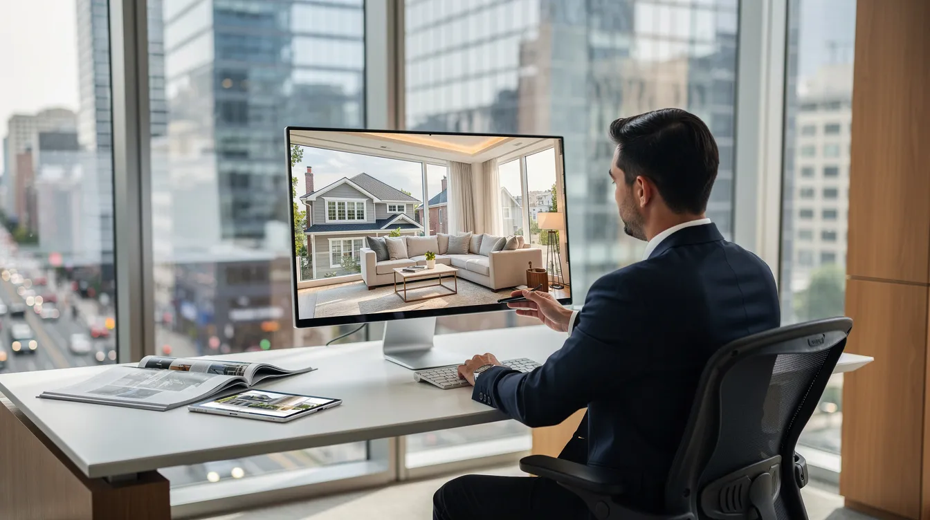
Planning an Atlanta Aerial Property Shoot With Masterly Property Visuals
Working with Masterly Property Visuals follows a straightforward process designed for busy commercial teams who need stunning visuals without project management headaches.
Step 1: Share the basics. Provide the property address, asset type, and square footage. Mention whether the property is occupied, under construction, or vacant.
Step 2: Clarify your marketing goals. Are you selling, leasing, raising capital, or supporting an entitlement application? The goal shapes the shot list, the angles, and the final deliverables. A disposition campaign for an industrial campus requires different imagery than a lease-up for a new multi-family project.
Step 3: Choose your package. Select between aerial-only or combined aerial and ground photography. Full packages with more images give your marketing efforts broader reach and showcase every feature that matters - from art deco lobby details to rooftop mechanical screening.
Step 4: Confirm timing. Masterly Property Visuals coordinates around weather, tenant schedules, and major Atlanta events that may affect traffic or airspace. Photo delivery typically occurs within one to two business days, keeping your project timeline on track.
Shot lists are customized by asset class. Industrial shoots focus on truck flow, loading areas, and trailer parking.
Retail captures signage, co-tenancy, and access lanes. Office listings prioritize lobby shots, amenities, and skyline context. Multi-family photography covers pools, courtyards, and proximity to nearby cultural attractions, the city's culinary scene, and neighborhood life that help attract buyers and tenants alike.
Every shoot delivers full rights to all images and video, so your team can deploy them across any channel - from LoopNet listings to investor decks to social media - without licensing restrictions. The art of effective property marketing lies in having high quality images ready when opportunity strikes.
Ready to plan an Atlanta aerial property shoot? Contact Masterly Property Visuals today to discuss your property, your goals, and the right visual approach for your next listing. Visit www.masterlyvisuals.com or call (404) 726-7261 to schedule your session.
FAQs About Drone Real Estate Photography in Atlanta
These FAQs address the most common questions from Atlanta commercial brokers, developers, and property managers.
Can drones fly over busy corridors like Downtown, Buckhead, or near Hartsfield-Jackson? Yes, but every flight requires case-by-case airspace evaluation. FAA-compliant drone operations near Class B airspace demand proper authorization through LAANC or direct ATC coordination. Masterly Property Visuals handles this process so clients can focus on selling, not regulations.
What kinds of commercial properties benefit most from drone photography? Logistics facilities, mixed-use projects, retail centers, office towers and office buildings, medical campuses, higher-education properties, and multi-family communities all benefit. Any property where location, access, and scale are part of the value story gains from aerial content. Drone photography captures what a ground-level showcase simply cannot.
How do aerial and ground photos work together? Aerial imagery establishes context and property locations. Ground-level photos capture interior finishes, materials, and the pedestrian perspective. Together, they create a complete visual representation for offering memoranda, online listings, and investor decks. Packages with more images sell properties faster and for higher prices.
What about tenant privacy? Careful framing, advance communication with on-site managers, and avoidance of sensitive areas protect tenant operations. No images are published without client review.
When is the best time of year to shoot in Atlanta? Early fall and spring offer the best balance of light and foliage. Winter leaf-off provides clearer ground views and skyline shots. Summer brings lush greenery but also haze and afternoon storms, so morning flights are essential. Aerial imagery helps showcase dense tree canopies and suburban yards year-round with proper planning.
For property-specific questions beyond what's covered here, contact Masterly Property Visuals directly.
Plan your Atlanta aerial property shoot now and elevate your commercial listings with Masterly Property Visuals. Call (404) 726-7261 or visit www.masterlyvisuals.com to get started today..
Recent Posts